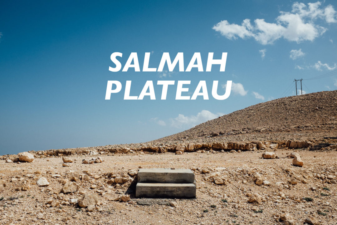

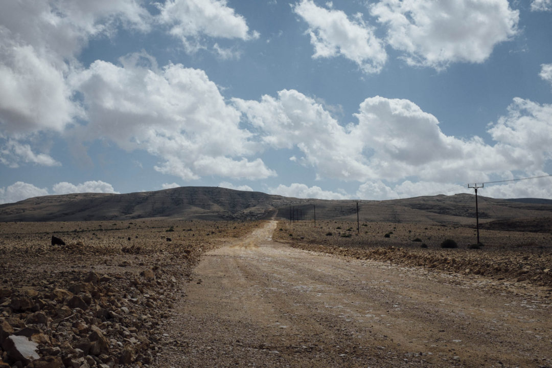
The Salmah Plateau is located in the Eastern Hajar mountains, and if you have been to the Western Hajar mountains you will notice a striking difference. Here the hills form a gentler landscape that is mostly devoid of vegetation, giving the Salmah Plateau and the surrounding mountains a desolate feel.
[table id=24 /]
Don’t let that slow you down, however. The gentler landscape is a result of a soft, young rock, which allows for a greater rate of erosion from water, causing fantastic natural features above ground and below.
The Salmah Plateau, and surrounding mountains, is home to no less than seven underground cave entrances, three of which portal spelunkers down into the world renown Majlis al Jinn (Meeting Place of the Spirits), one of the largest cave chambers in the world. Access is only available via a 118-158 meter rappel into thin air, depending on which entrance used. The cave chamber measures about 310 by 225 meters with a 120 meter tall domed ceiling that is only 40 meters thick and contains the three entrances.
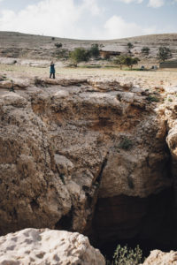 The Majlis al Jinn, locally known as Khoshilat Maqandeli, is currently off limits by government order, but Muscat Diving & Adventure Centre offers guided trips to the slightly less demanding 7th Hole Cave as an alternative. This one doesn’t require you to ascend out via rope, but you do get a nice underground hike out of it.
As highlighted above the Salmah Plateau is a fantastic place to explore, and has an even more fantastical etymology to its name, as researched by Authors Anne Dale and Jerry Hadwin in their book Adventure Trekking on Oman:
Long ago, Selma, a local shepherdess tending her flock on the plateau, needed to go and fetch water. Leaving her flock in a cave, she set off, returning hours later to find a leopard eating one of her goats. Her first thought was to defend her flock so she picked up an axe, advancing towards the leopard. She was attacked but managed to bring the axe down on the leopard’s head, splitting it wide open. Both were mortally wounded. Later they were found lying together, the axe by their side. God was so impressed that he sent down seven stars from the heavens to make the seven khoshilat [cave shelters] as a memorial to Selma’s bravery.
We can break down three topics in this story to learn more about the Salmah Plateau.
Firstly, Arabian leopards are no longer found in the Hajar Mountians. Good for you but sad for the animal and the environment. The feline is critically endangered with maybe only 200 remaining in the wild between Oman and Yemen. Oman is trying to conserve and protect the big cat, creating the Jebel Samhan Nature Reserve in the Dhofar Governorate, but it might be too little too late. “The animals’ range is increasingly fragmented by development, overgrazing and herders who shoot or poison them lest they prey on their goats, cows and camels.” Exacerbating the issue is a lack of education and law enforcement.
Secondly, God sent down seven stars to make the seven khoshilat. The number seven is significant as this is the number of cave entrances that can be found in the area. A khoshilat is kind of a cave shelter in arabic, and more specifically a goat shelter. Which brings us to our third topic.
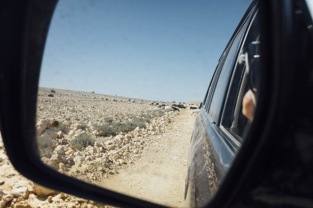
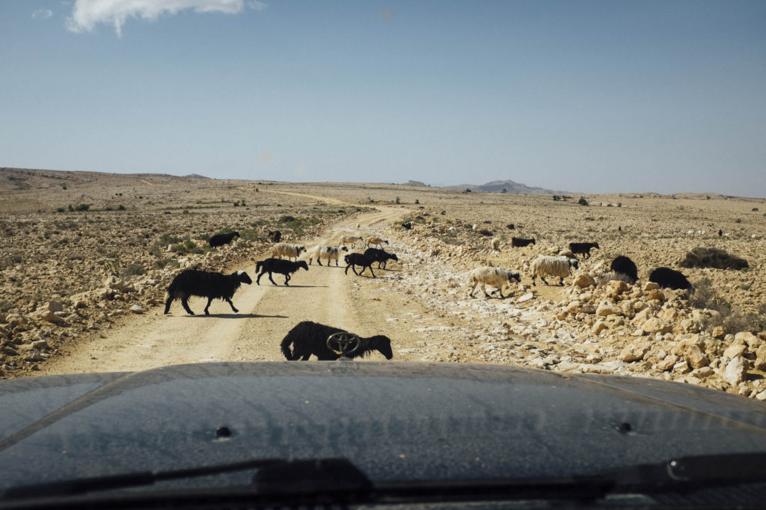
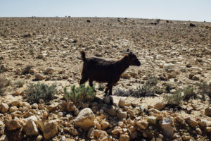 Goats! Salmah Plateau may not have a huge human population in the dozen or so villages, but it does have a large number of goats, same as in the folk story. Women take the lead in herding the goats and sheep, so don’t be startled if you hear women singing off in the foggy distance just after sunrise. It’s hard to imagine such a desolate place supporting large herds of goats and sheep, but stranger things can be found on the plateau.
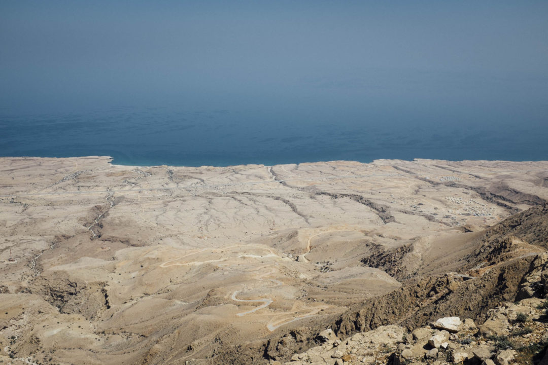
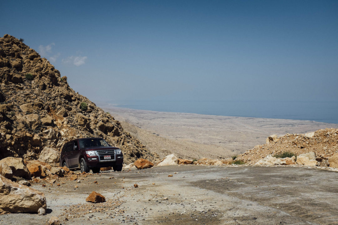
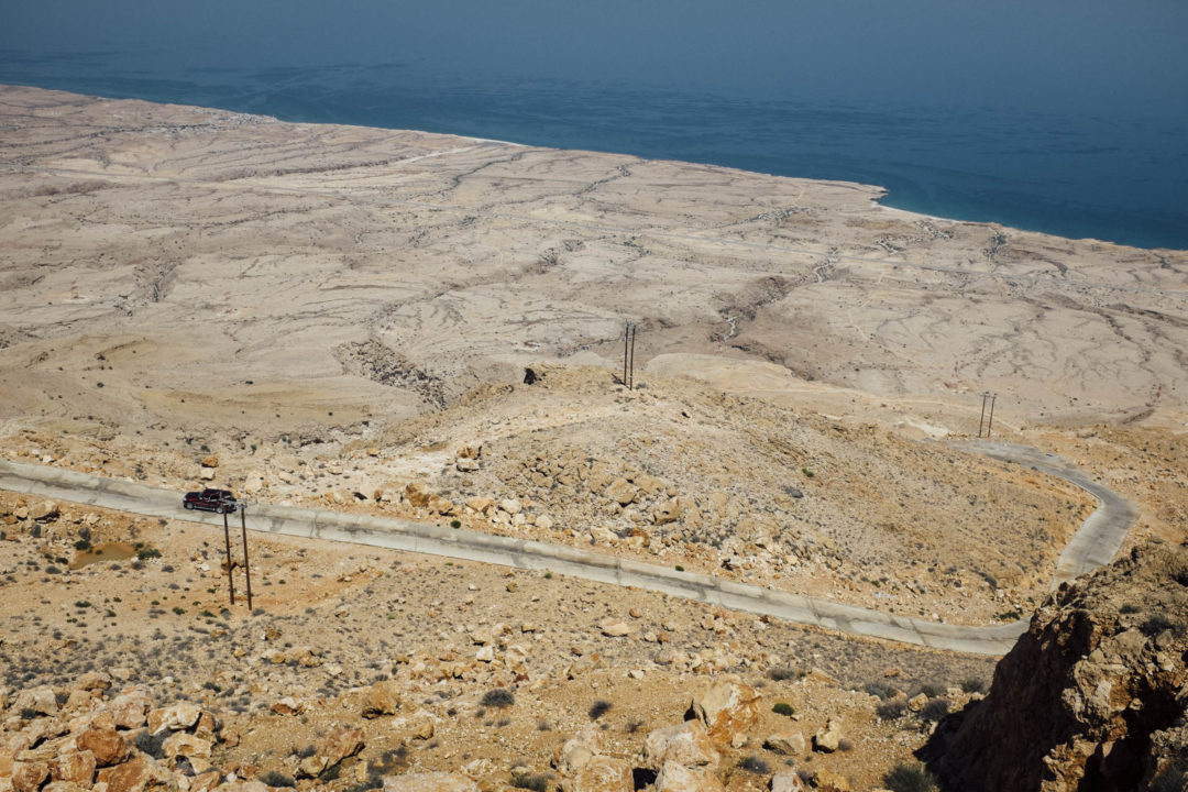
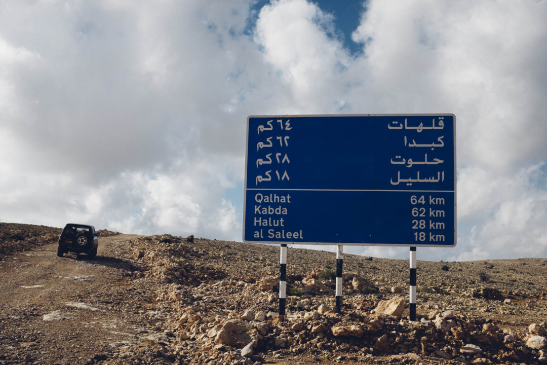
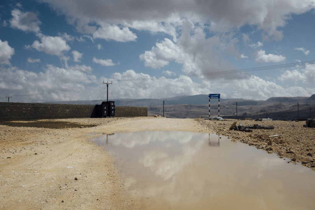
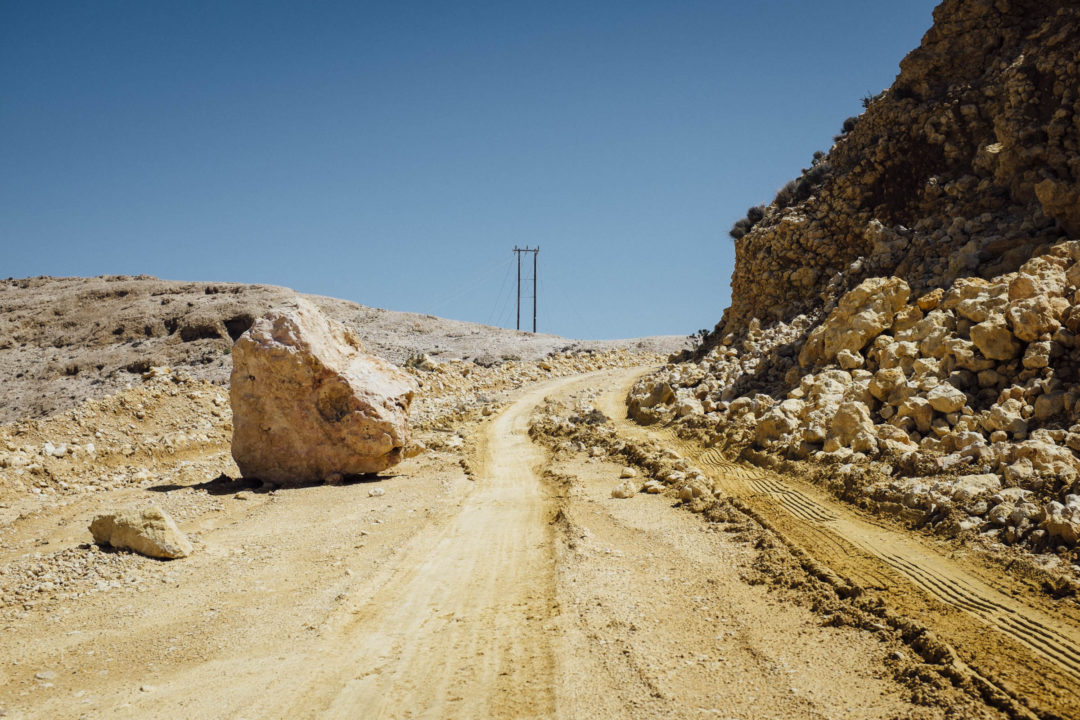
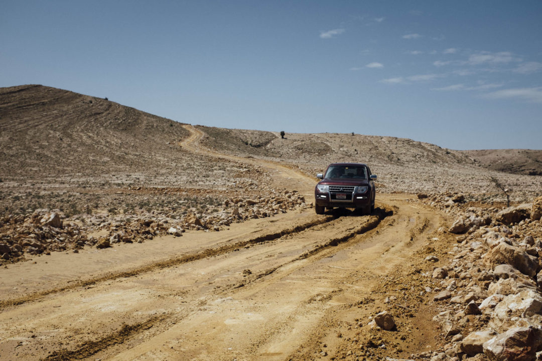
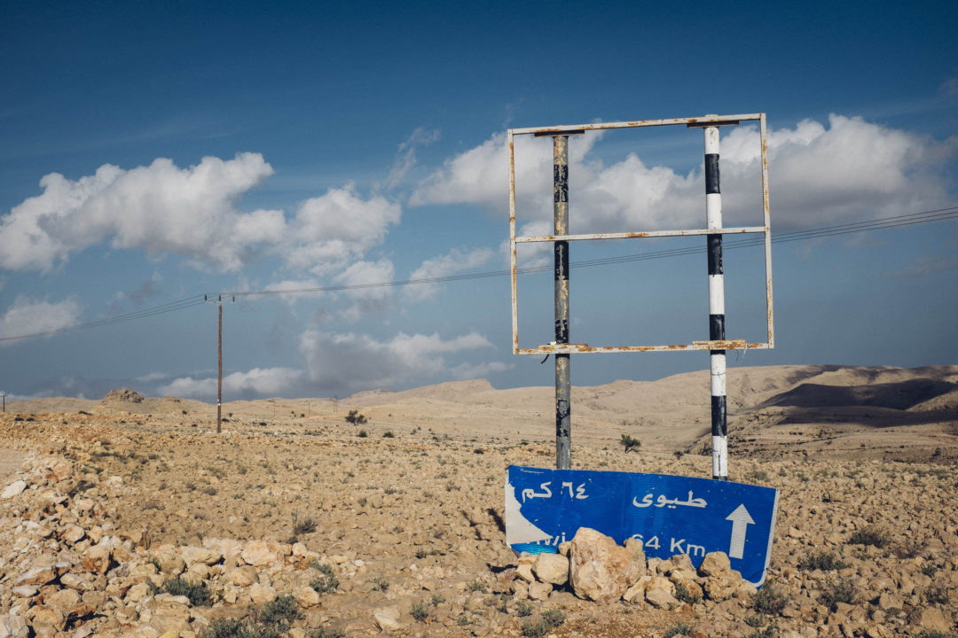
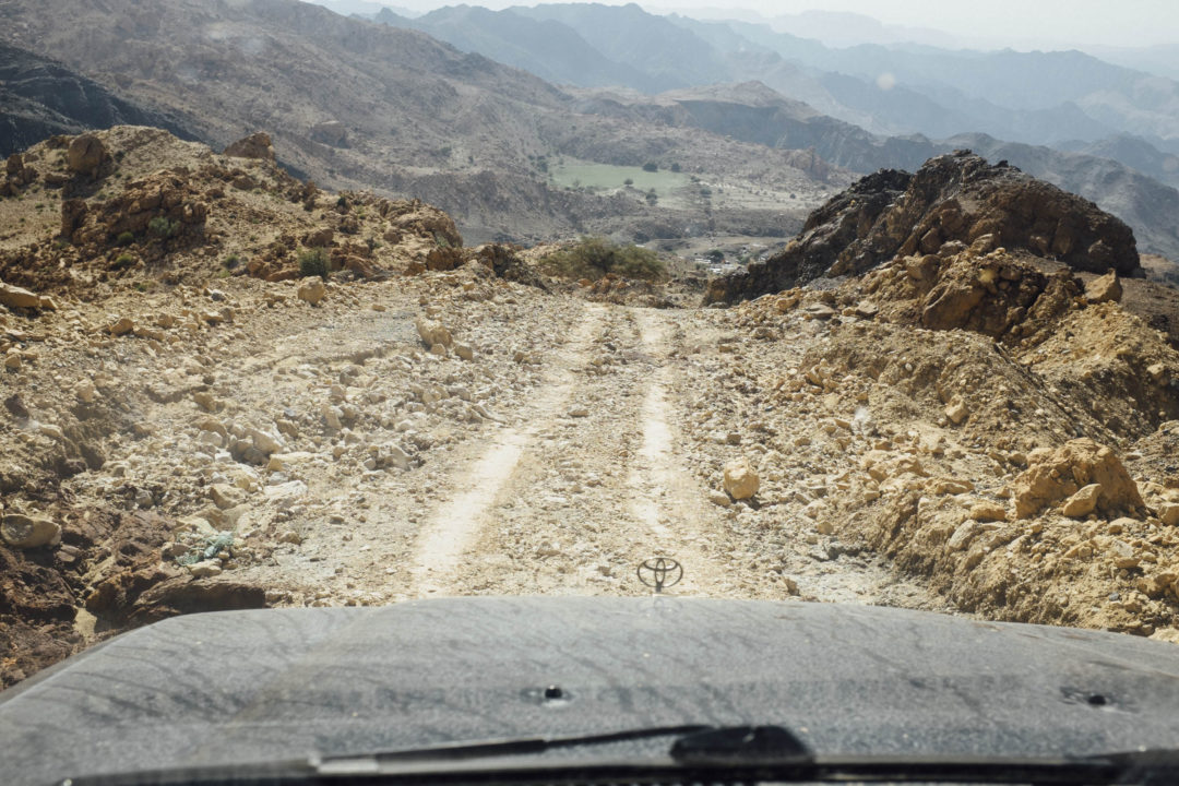
Reaching the Salmah Plateau and beyond is no walk in the park. Two hair-raising tracks, that didn’t even exist a decade ago, give access to Salmah Plateau from the seaside Route 17 between Muscat and Sur. The tracks feel little more than goat trails carved into the side of the mountain, but over the years improvements have been made to both tracks to better control the rate of erosion to the tracks during rains. Nonetheless, a proper 4WD with selectable low-range is required to grunt your way up the mountain, and safely back down.
The northern track, closer to Quriyat and Muscat, gives better access to Majlis al Jinn and secluded camping with amazing sea views. It’s my preferred track, all things being equal.
The southern track, closer to Sur, has a shorter distance between the climb and Route 17, so you can get up to the plateau a bit quicker. It also features better pavement in the switchbacks, so I like to think of the southern track as the all-weather track to Salmah Plateau and beyond.
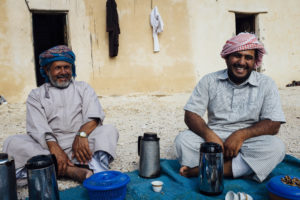 Both tracks meet up at the village of Qurun, nestled into the side of a wadi, with some of the friendliest locals. I have made a few fiends there, so be sure to stop and give Salam to anybody who waves at you, you might just be treated to some Omani hospitality with dates, coffee, fresh goat laban, or even lunch!
Exiting out the back of Qurun you can explore a number of track, visit the Jaylah Tower Tombs, or continue across the mountain range, to an access point on the west side of the mountains which can take you to Ibra. From Ibra you can continue your journey south via the Wahiba, Kamal, or Sinaw. Or west to Nizwa and the cultural capital.
Of course this off-road journey can be run in reverse from Ibra to the sea.
I do find the full trip a bit long. While the distances don’t appear to be great, off-road travel requires finesse and caution, especially on the steep climbs and descents. One wrong move, and it’s lights out. No guardrails here. So, I prefer a more leisurely jaunt. Climbing up one track from the sea. Exploring, camping, and hiking. Then returning via the opposite track towards the sea.
Explore More on Salmah Plateau
[table id=38 /]
Salmah Plateau Tips and Things to Consider
- Consider picking up any hitchhikers thumbing for a ride up or down the mountain. These expat workers, often from Pakistan and Bangladesh, have no other way to get around. I bet you’ll learn something interesting from them in return.
- Bring little candies for the local kids, otherwise they will con you out of your all your sweet drinks.
- Bring spare water for the local adults if they stop you and ask, which they often do. Water is the most difficult resource to truck in.
- Mornings can be wet with fog and dew. Consider sleeping under a tarpaulin or awning if sleeping outside of a tent.
- Fill your fuel tank in Quriyat, if coming from Muscat. Sur, if coming from Sur. Or Ibra, if coming from Ibra. There are no services on the plateau.
- Engage low-range 4×4, and select and keep a low gear for the steep descents. This will allow you to “engine brake” the long downhill. Saving your brakes, and giving you more control.
- Visiting in the summer months is still possible, the days will be warm, but nights could be 25C thanks to the 1400m or so altitude.
What do you like better, the mountains or the beach? Leave me a comment below:
[osm_map_v3 map_center=”22.793,58.91″ map_border=”solid thin #F0F0F0″ zoom=”10″ width=”100%” height=”450″ file_list=”../../../../wp-content/uploads/2016/05/022_salmah_plateau_fins_qurun_track.gpx, ../../../../wp-content/uploads/2016/05/023_salmah_plateau_shab_qurun_track.gpx, ../../../../wp-content/uploads/2016/05/024_salmah_plateau_qurun_jaylah_tombs_track.gpx, ../../../../wp-content/uploads/2017/01/025_salmah_plateau_majlis_al_jinn_wpt.gpx, ../../../../wp-content/uploads/2016/05/026_salmah_plateau_qurun_village_wpt.gpx, ../../../../wp-content/uploads/2016/05/027_salmah_plateau_jaylah_campsite_wpt.gpx, ../../../../wp-content/uploads/2016/05/028_salmah_plateau_qurun_ibra_track.gpx, ../../../../wp-content/uploads/2016/05/029_ibra_shell_petrol_station_wpt.gpx, ../../../../wp-content/uploads/2016/05/030_ibra_hospital_wpt.gpx” file_color_list=”red,red,red,red,red,red,red,red,red” type=”cycle map” control=”scaleline”]
 Disclaimer: While every effort is made to provide accurate information, this information is made available with the understanding that data is provided with no warranties, expressed or implied, concerning data accuracy, completeness, reliability, or suitability. This site and its contributors shall not be liable regardless of the cause or duration, for any errors, inaccuracies, omissions, or other defects in, or untimeliness or inauthenticity of, the information, or for any delay or interruption in the transmission thereof to the user, or for any claims or losses arising therefrom or occasioned thereby. The end user assumes the entire risk as to the quality of the data.
Sources
[easyazon_link identifier=”0953785408″ locale=”US” tag=”beyotherout-20″]Dale, Anne, and Jerry Hadwin. Adventure Trekking in Oman. Leicester: Cordee, 2001. Print.[/easyazon_link]
“Oman Struggles to save Arabia’s Last Leopards.” Gulf News. AP, 16 Aug. 2013. Web. <http://gulfnews.com/news/gulf/oman/oman-struggles-to-save-arabia-s-last-leopards-1.1221145>.
6 Comments
It’s a tough one but I prefer the beach because it’s warmer and I love swimming in the sea. However, would you recommend visiting the mountains to escape the heat of the city?
Yes, the mountains are the number one way to beat the heat in Oman.
How many goats do you find on the plateau?
Loads! Sorry, I can’t be exact.
An excellent description of the area. I will include your website in my soon to be published map of the Ash Sharqiyyah Governorates.
Thanks Anne, glad you like it.