Jebal Akhdar (الجبل الأخضر) is a beautiful mountain in the Al Hajar Mountains of Oman, and literally means Green Mountain in English. However, Jebal Akhdar isn’t just a cute name intended to attract visitors (like Hawaiian Gardens, California… don’t visit there). Jebal Akhdar is GREEN, and a surprising oasis in the hot desert.
[table id=35 /]
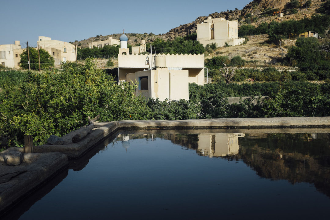
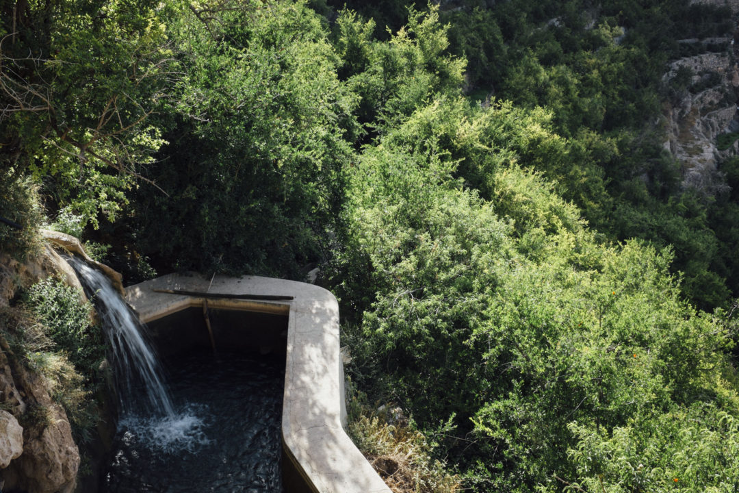
Situated about 40 minutes from the interior capital of Nizwa, Jebal Akhdar peaks at just shy of 3,000 meters (9,840 feet), depending on who you ask. On the mountain we find a number of tiny hamlets peppered around the mountain, located near water sources which feed afalaj irrigation systems for agriculture. Crops include the famous roses, pears, apples, walnuts, figs, grapes, plums, apricots, saffron, and world renown pomegranates. The Mediterranean climate is so good for agriculture that His Majesty Sultan Qaboos keeps his own private farm on the top of mountain.
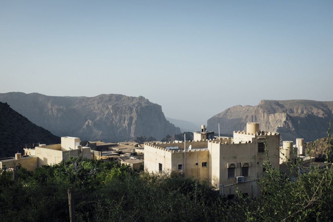
The main geographical feature on the mountain is Saiq Plateau where the main town, called Saiq, is located along with a Royal Oman Army base. Saiq is a modern town and is expanding at a rapid rate, like most of Oman. Here you will find a petrol station, basic grocery stores, and a sea of 2-3 story houses. Beyond that there isn’t much to see inside the town, so shift your attention to the epic views nearby.
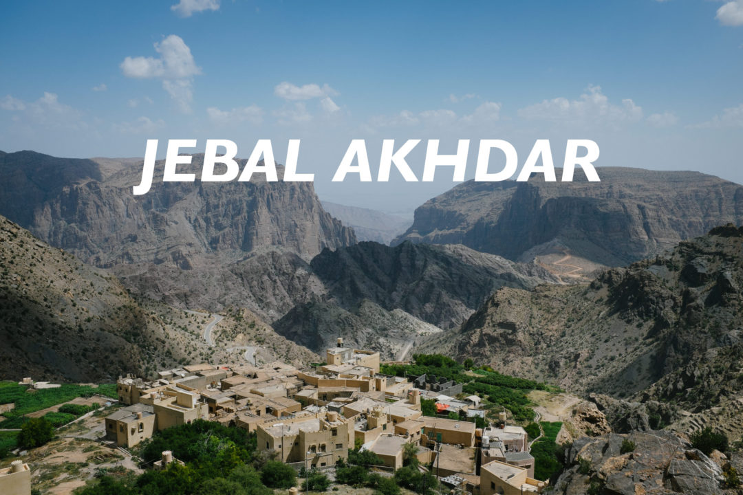
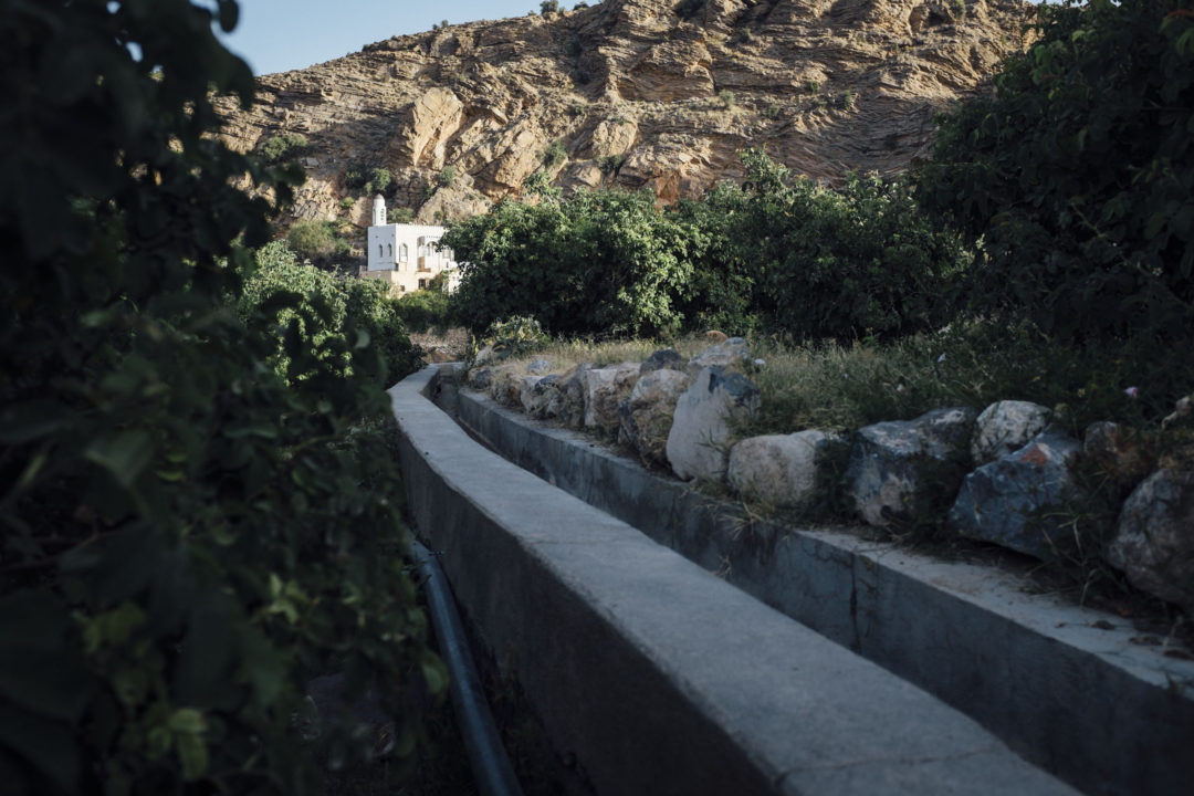
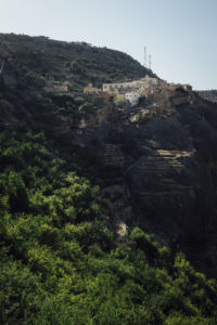 Al Ayn
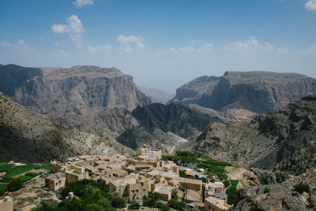
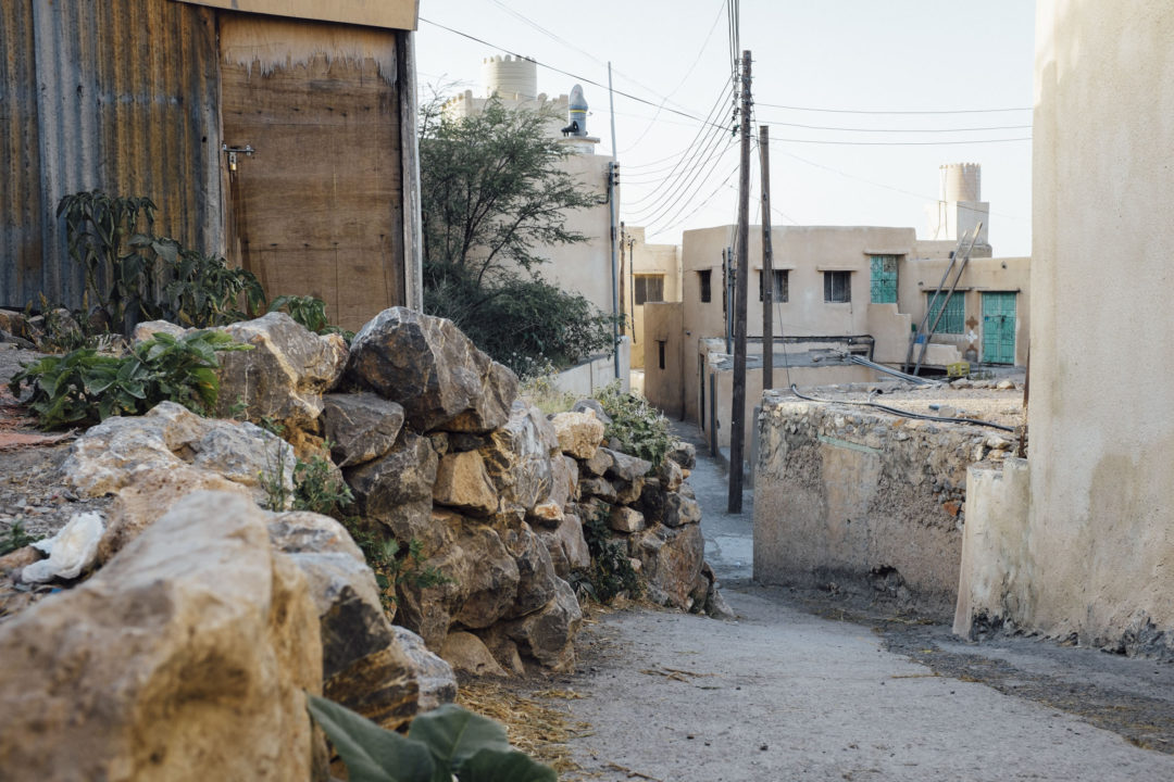
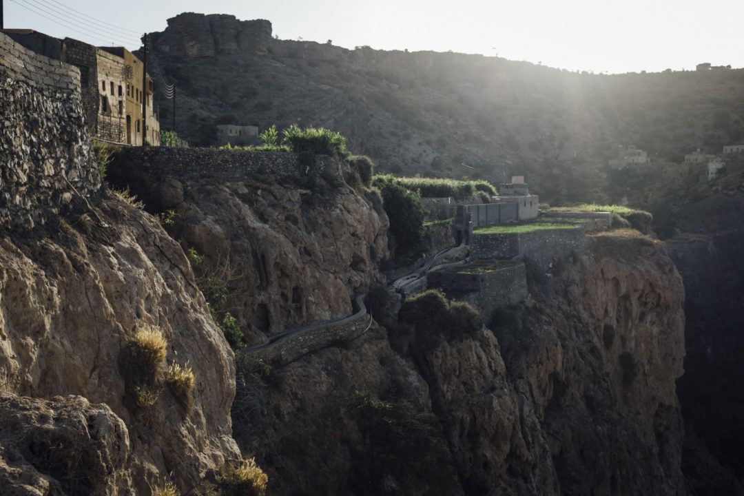
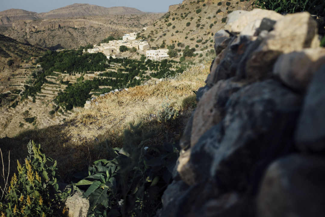
Just outside Saiq is my favorite lookout on the mountain, just above the hamlet of Al Ayn. From here you can see straight down the jagged wadi, past the green terraced gardens from ancient times, between two massive cliffs, and if the weather is clear, the boiling desert below. In the foreground of all this you have quaint, little Al Ayn; silently nurturing her precious fields.
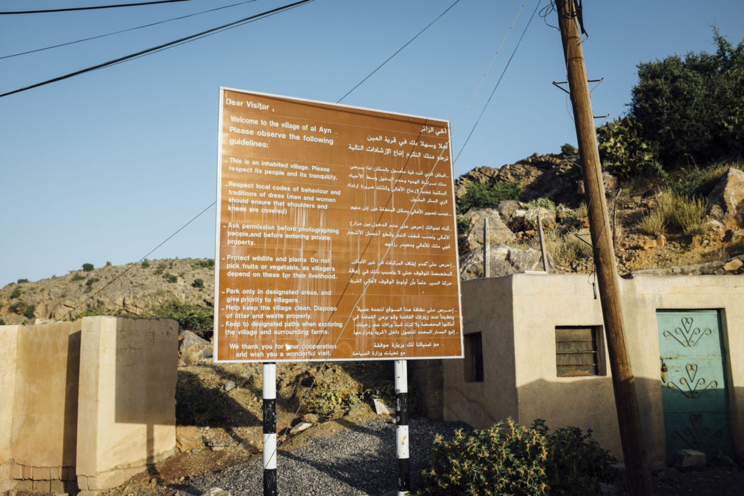
Al Ayn is like many hamlets on Jebal Akhdar, lost in time. If you remove the ugly power lines, petrol powered 4x4s and smooth pavement; you are instantly transported back in time 1,000 years. Head down the hill to the parking area and take stroll through the hamlet. The locals are friendly, especially when you give the traditional greeting as-salām ‘alaykum (السلام عليكم).
The Jebal Akhdar War
 During the 1950’s the locals might not have been so friendly. A war broke out when the sultan’s father, Sultan Said bin Taimur, tried to wrestle power back from the interior government, the Imamate of Oman. Basically the autonomous Imamate of Oman thought The Sultanate of Muscat and Oman was breaking the Treaty of Seeb by negotiation oil deals on land that they controlled domestically.
The sultan didn’t think so because these were international affairs with international companies, which were explicitly the right of the Sultanate of Muscat and Oman to enter according to the treaty. The fight was on, and eventually entered a period of a long stalemate because the Imamate of Oman’s leaders, backed by Saudi, retreated to the seemingly impenetrable Jebal Akhdar. In 1959 the British, who supported and coordinated with Sultan Said bin Taimur, victoriously dispatched SAS soldiers up the southern face of the jebel to retake the enclave. There was little fighting in the action.
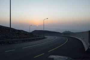 You don’t need SAS stamina and a grueling hike to reach Jebal Akhdar nowadays. A silky smooth tarmac road guides your magic-carpeted-ride straight up in about 30 minutes. The only requirements are a 4×4 for the steep terrain, and your vehicle and personal IDs. All of which may, or may not, be checked at the police checkpoint at the bottom of the mountain.
If you are touring Oman in a sedan and still want to visit Jebal Akhdar, you can hire a 4×4 for the day from a local company (see the map below), or hitchhike! I always pick up a local or two at the bottom of the mountain at the police checkpoint looking for a ride. You can join them too.
This post is the first in a series of post coming in the months ahead. Don’t miss out on any posts be signing up for my monthly newsletter.
[mc4wp_form id=”367″]
Jebal Akhdar Tips and Things to Consider
- The campsite marked in the GPX file below is pointing to a general area, once you reach this place you are free to drive around and find a spot you like. Driving north will eventually bring you to a cliff with a canyon below.
- A 4×4 is required even though the road is paved. The police might instruct you to engage 4WD, and depending on your vehicle model, driving on tarmac in 4WD could damage your system. Just know what your vehicle recommends. Engaging a low gear and driving slow is far more effective for staying safe then using the 4WD system on tarmac.
- Summer temperatures could reach into the teens at night, and winter temperatures below freezing. Be sure to bring warm enough bedding and a jacket.
What to do on Jebal Akhdar:
- Hiking – the number one activity
- Try out the via ferrata at Alila Jabal Akhdar
- Observe the Rose Harvest
- Explore the terraced gardens (see the map below)
- Discover abandoned villages
Where to stay on Jebal Akhdar:
- Camping is my recommended form of overnight stay (see the map below for the site).
- Alila Jabal Akhdar – pricey but maybe the best hotel in all of Oman. I sometimes splurge for a nice lunch overlooking the wadi below.
- Anantara Al Jabal Al Akhdar Resort – Another posh hotel, not as pricey as Alila.
- Shab Hotel
- Jabal Akhdhar Hotel
Jebal Akhdar Map
[osm_map_v3 map_center=”23.007,57.604″ map_border=”solid thin #F0F0F0″ zoom=”10″ width=”100%” height=”450″ file_list=”../../../../wp-content/uploads/2016/12/068_jebal_akhdar_camp_wpt.gpx, ../../../../wp-content/uploads/2016/12/069_jebal_akhdar_sultans_farm_wpt.gpx, ../../../../wp-content/uploads/2016/12/070_jebal_akhdar_alila_hotel_wpt.gpx, ../../../../wp-content/uploads/2016/12/071_jebal_akhdar_petrol_wpt.gpx, ../../../../wp-content/uploads/2016/12/072_jebal_akhdar_restaurant_wpt.gpx, ../../../../wp-content/uploads/2016/12/073_jebal_akhdar_restaurant2_ice_wpt.gpx, ../../../../wp-content/uploads/2016/12/074_jebal_akhdar_dianas_point_wpt.gpx, ../../../../wp-content/uploads/2016/12/075_jebal_akhdar_al_ayn_viewpoint_wpt.gpx, ../../../../wp-content/uploads/2016/12/076_jebal_akhdar_police_checkpoint_wpt.gpx, ../../../../wp-content/uploads/2016/12/077_jebal_akhdar_4x4_rental_wpt.gpx, ../../../../wp-content/uploads/2016/12/078_birkat_al_mouz_petrol_ice_wpt.gpx, ../../../../wp-content/uploads/2016/12/079_birkat_al_mouz_fort_wpt.gpx, ../../../../wp-content/uploads/2016/12/080_jebal_akhdar_saiq_track.gpx” file_color_list=”red,red,red,red,red,red,red,red,red,red,red,red,red” type=”cyclemap”]
 Disclaimer: While every effort is made to provide accurate information, this information is made available with the understanding that data is provided with no warranties, expressed or implied, concerning data accuracy, completeness, reliability, or suitability. This site and its contributors shall not be liable regardless of the cause or duration, for any errors, inaccuracies, omissions, or other defects in, or untimeliness or inauthenticity of, the information, or for any delay or interruption in the transmission thereof to the user, or for any claims or losses arising therefrom or occasioned thereby. The end user assumes the entire risk as to the quality of the data.
9 Comments
Hi,
Love your blog really useful!
We are staying at Alila Jabal Akhdar but I don’t drive! Are there any good 4×4 drivers you would recommend.
Thanks
Harita
Hi Harita, thanks for the comments and please share.
Regarding a 4×4 driver, I don’t have any recommendations from personal experience. Maybe the hotel has a pick-up service at the bottom of the mountain. You can check with them.
When will you be visiting and how long are you staying? I ask because maybe one of my students is driving that way and would want to earn a little extra money. The hire (if possible) would be private between you and local student, but of course I will make sure you’ll be with someone known to me. Send me an email through the contact section of my website or to d@qlq.wmj.temporary.site if this interests you.
Hi! Just completed the trip to Jebel Akhdar last weekend. Coming from Dubai it requires some driving, but it definitely worth it! Wanted to thank you for the website and the tips, esp. the fact it includes the GPS tracks.
In regards to the trip, we had some rain on Friday afternoon, but after Dubai 45+ degrees it was really refreshing:)
The camping spot shown by you is great, felt really nice there!
We continued on Saturday to Ibra and then did your Plateau trip in reverse. I have been there before, but the fact that the plateau can be accessed from other than sea side was new to me, as well as the tombs!
Last but not lease, thank you for introducing me to the application maps.me, it worked well with your GPS tracking files and is user friendly too…
I am really looking forward to keep exploring Oman, next focus is definitely on Khaluf Beach area, again using your records:)
Cheers, keep it rolling!
Jan
Hi Jan. Glad you found my site useful and enjoyable. This is exactly the goal. Keep tuned to this site and maybe sign up for the email newsletter. There is something in the works that you will find exciting if you liked the website so far. So, stay tuned! And email me next time you are coming to Oman.
Thank you so much for putting all of this together. You made our weekend trip happen!
Hi Shruti, so glad to hear this helped you. Thanks for giving the feedback. What’s next?
Saal Trek is up next! Just trying to figure out the coordinates as we speak :)
hello.. how do i open this map in my google maps ?
please advise
You can read about it here. Best to use a separate application to reach them. The files a linked above.